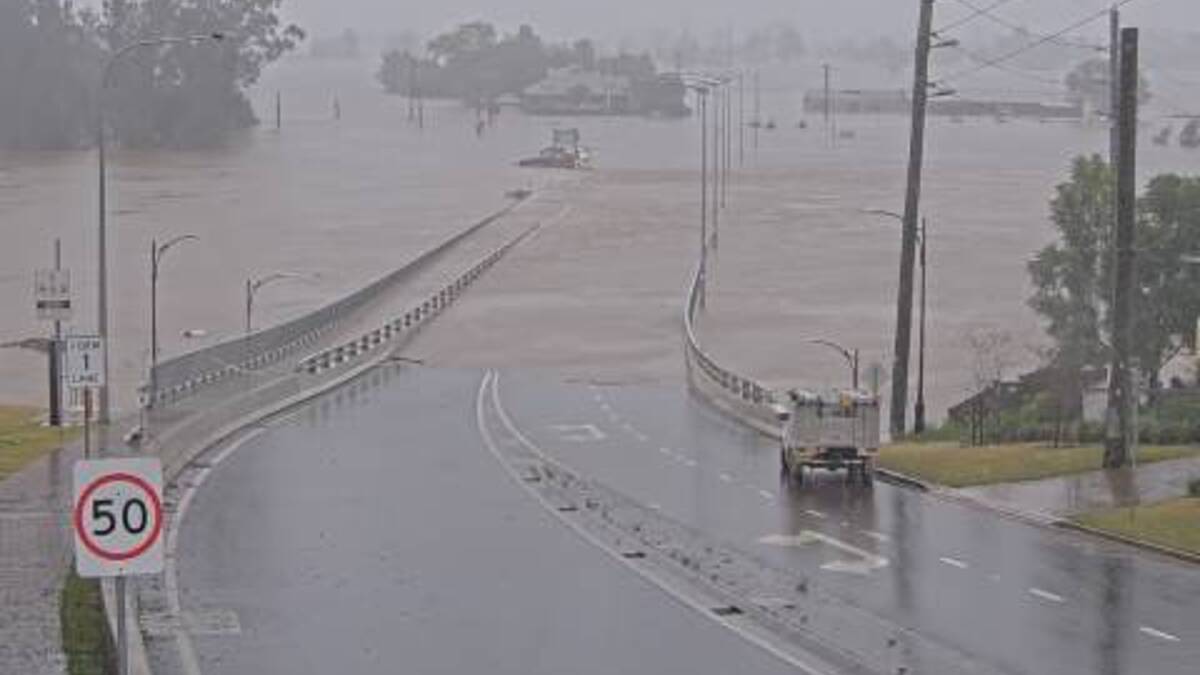
Windsor Bridge was the latest to succumb to flood waters this morning, joining Richmond and Yarramundi bridges and numerous roads affected by flood around the Hawkesbury.
Create a free account to read this article
$0/
(min cost $0)
or signup to continue reading
The Hawkesbury River had reached 12.63 metres at Windsor with major flooding, and was still rising at 10.45am Monday morning.
The Bureau of Meteorology (BOM) estimated that the river at Windsor would reach 13.3 metres Monday afternoon. This is below the March 2022 peak of 13.7 metres, but higher than the March 2021 peak of 12.9 metres.
The Hawkesbury River at North Richmond was at 14.02 metres and rising at 11.13am Monday, after having peaked at 14.18 metres around 3.15am Monday, with major flooding. The river fell to 13.96 metres around 10am before starting to rise again.
Yesterday at midday there were 74 road and ferry closures around the Hawkesbury, according to Hawkesbury Council's Disaster and Emergency Dashboard.
Road closures include Macquarie Street between Bell Street and Brabyn Street at South Windsor, Hawkesbury Valley Way near Crowne Plaza, and Pitt Town Road.
Visit livetraffic.com and disaster.hawkesbury.nsw.gov.au for updates.
The latest weather update from the Bureau of Meteorology (BOM) states that, although rainfall rates have generally eased, localised heavy rainfall which may lead to flash flooding remains possible until later this evening over the Illawarra, Blue Mountains, Sydney Metropolitan, and parts of Hunter (including Central Coast) districts.
Isolated three-hourly rainfall totals between 50 to 75 mm are possible.


